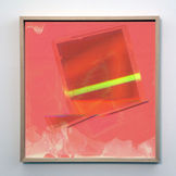
JAMES GEURTS
b. 1970
Lives and works in Melbourne
Through critical investigation James Geurts draws out geographic and conceptual forms that are layered within specific sites of research. The artist examines how natural and cultural forces shape perception.
Geurts works across the disciplines of sculpture, drawing, video, photography and Land Art.
Exhibitions include: National Gallery of Victoria; White Cube, London; TarraWarra Biennial, awarded the ACME Studio residency London, Australia Council for the Arts, Gemak, Den Haag Netherlands; Centre for Contemporary Art, Tel Aviv Israel; The Sovereign Asian Art Prize, Hong Kong, Art Gallery of South Australia, Adelaide; La Chambre Blanche, Quebec; and the Australian Centre for Contemporary Art.
WEATHER ACTIONS / 2002 - 2025
PUBLIC WORKS / 2016 - 2025
APERTURE (HERO) / 2022
Aperture F/1.2_Shallow Inlet, 2022
Site-action (sculpture 3.6m diameter)
Fluorescent tubes, marine ply, solar panel, battery, converter
Shallow Inlet, Victoria
Melbourne City Council Billboard Commission
10.4m x 3m vinyl print
HERO Building by Fender Katsalidis Architects, 118 Russell Street Melbourne
Aperture f/1.2_Shallow Inlet is a time specific site-action that contemplates the relationship between the optics of the human eye, the mechanics of a constructed lens and earth’s orbital relationship with the light of the sun. The concept involved collecting the solar energy from day of installation then illuminating the sculpture at the exact time the sun disappears below the horizon, transforming the residual natural light of the sun into artificial light turning cyclical time into a linear event. The symbol of the photographic lens operates as a contemporary interface between the viewer and viewed, the surveyor and the surveyed. The sculpture was made at the southernmost point of the Australian mainland near Wilsons Promontory and installed in the centre of Melbourne City.
EON PROJECT / 2022
EON PROJECT, 2022
Bronze sculptures and single channel video
TCL-Kevin Taylor Legacy Grant
GAGPROJECTS
Melbourne Art Fair satellite space
Norla Dome, Mission to Seafarers Melbourne 2022
EON project is a site-responsive installation exploring the perception of time, connecting the primordial with the technological, from evidence of the earliest forms of multi-cellular life to the proliferation of satellite mega-constellations which orbit the earth. The crystalline structures of the satellite sculptures evoke the fracturing of linear time, warping and transitioning as evolving interfaces of relayed information. The placement of the sculptures in the Dome are in relationship with the light movement and refraction anomalies occurring through the oculus at various times of the day.
An Eon spans approximately one billion years, the duration of the formation of the Flinders Ranges SA where the research of EON project took place, where satellite dishes punctuate the outback landscape amplifying the increasing mesh of technology. The transition from formless unicellular life to multicellular life was momentous and is the basis of co-ordinated cellular structures that form the diversity of life today and the hyper-connectivity of the contemporary world.
"Do we measure time or is time being measured? In his investigations into the phenomenology of time consciousness and motion... weather tracing internal water structures, frequencies, information exchange, perception and the origins of the earliest forms of multi-cellular life... interdisciplinary artist James Geurts reveals the gravitational interactions between time and measurement. Shadowing phenomenologist Edmund Husserl’s statement that: every perceived time is perceived as a past which terminates in the present, the present being the boundary- point... Geurts’ interrupts both the present and the perceived past to create a new demarcation and a new visual field of consciousness.''
Extract from forthcoming EON essay by Melissa Bianca Amore
The research, development and exhibition of EON project was generously supported by the TCL-Kevin Taylor Legacy Grant, which included an artist residency in the Flinders Rangers, South Australia. Kevin Taylor was a founding director of TCL Landscape Architects Melbourne and Adelaide.
STANDING WAVE / 2022
Standing Wave: Pt Nepean
, 2022
Kinetic site-responsive light sculpture
Fluorescent tubes, intervened circuitry, aluminium structure
5.2m x 4.2m x .4m
Q-Studio, Quarantine Station, Point Nepean National Park/Monmar
Curated by Cameron Bishop and Danny Lacy,
supported by David Cross and Simon Reis
FRONT BEACH BACK BEACH Festival 2022
In physics, a standing wave is a phenomenon occurs when two waves of the same frequency and wavelength move in opposite directions, as the waves meet, they become superimposed, giving the illusion of the wave standing still, creating a harmonic resonance. Standing Wave: Pt Nepean arrests the senses and overwhelms the body in a hypnotising pulsing field, an optical illusion of spatial uncertainty, a wave within a wave, a bioelectric composition, an exposed grid of fluorescent tubes form a breaking wave, collapsing under the pressure of extreme weather.
Standing Wave underlines the fragility of contemporary cities amongst the earth-scale shift of increasingly volatile weather conditions. Suspended in a state of ignition, the oscillating structure becomes a living body, the more time you spend with the pulsing light it starts to transform, your perception adjusts and the artwork re-emerges as a new elaborate ecological rhythm expanding in your periphery.
“James Geurts finds the confluence of things, between the primordial, the technological and the astronomical. What Geurts’ kinetic sculpture calls on here is a reverence for how the shape of the sea floor, and forces of the moon and tides bring the phenomenon of the standing wave into being. A wave that appears to hold its form, without moving, and yet the forces that go into its eminence are planetary, much like our own bearing on the world.”
Dr Cameron Bishop, curatorial essay FBBB
TIME ZERO / 2022
TIME ZERO: INTERNATIONAL DATELINE, 2022
Bronze
80 x 25 x 25cm
The Sovereign Asian Art Prize, Hong Kong 2022
GAGPROJECTS Online exhibition, Berlin and Adelaide 2022
The Habitat of Time, Arts Catalyst London, curated by Julie Louise Bacon 2020
Awardee, National Small Sculpture Prize, McClelland Sculpture Park+Gallery 2020
Time Zero: International Dateline is based on a constructed geopolitical line drawn from the North Pole to the South Pole positioned at 180° longitude, demarcating one global calendar day from the next. This is an earth-scale conceptual art project that marks the meridian line of the time interval of zero. Time Zero gives material form to an invisible phenomenon: time. This gesture cast in the ancient technological material of bronze connects a pre-modern age with the system of time zones that developed in the industrial era. An intentional schism has been created in the two planar surfaces, like tectonic forces, emphasising the continual movement of this line by political and economic tensions.
FLOW EQUATION / 2021
ELECTRIC WATER / 2021
Notes from the Field: Bogong Centre for Sound Culture
MAMA (Murray Art Museum Albury) 2021
Deconstructing A River: Electric Water is a series of conceptual site-actions that underline the transformation of water flow into electrical current at the Dam wall of Lake Guy, Kiewa Hydroelectric Scheme, Bogong High Plains. These site-actions work across the mediums of drawing, neon and video, and focus on the intervention of a river's agency, where its self-determined trajectory of the Kiewa river is reconstituted as a measured entity of civilised usefulness.
Notes from the Field, curated by Madelynne Cornish and Philip Samartzis, brings together the work of 15 artists who have been residents at Bogong Village over the last ten years, with work presented both in the gallery spaces and online. Notes from the Field celebrates the initiative of this globally reaching and supportive artist residency program in North East Victoria. The artists have observed and recorded the dissonance between landscape, humans and technology.
90 DEGREES EQUATORIAL PROJECT/ 2007 - 2018
90 Degrees Equatorial Project, 2007
McClelland Sculpture Park+Gallery 2018
Resurveying Site, Zhulong Gallery, Dallas Texas 2015
Australian Experimental Art Foundation, Adelaide 2007 (Now ACE)
GAGPROJECTS
Conceptual land art project
Four site and time-specific installations took place 90 degrees apart on the equator (the meridian line of zero) and were photographed 6 hours apart to create a 24 hour earth cycle.
170° East_Kiritimati Atoll, Pacific Ocean 16:00
80° West_Pedernales Ecuador, South America 22:00
10° East_Kango, Gabon, Africa 04:00
100° West_Koto Padang, Sumatra, Indonesia 10:00
The modular sculpture was back lit with an embedded solar light unit, this set up a contrast between fluctuating exterior natural light and consistent interior technological light.
Excerpts from - 90 Degrees Equatorial Project, by Russell Storer 2007, Head Curator International Art, National Gallery of Australia:
The phrase 'four corners of the globe’ is an obvious antilogy, yet it’s one we take for granted. It doesn’t specify anywhere in particular, merely indicating an all-encompassing spatiality. If we were, however, to try and locate these magical corners, where might they be found? The word 'corner' indicates something slightly shadowy or forgotten, a dusty, neglected pocket of a place, far from the comfortable centre of things.
It is when we are forced to consciously consider this process of perception that another form of experience is opened up to us. Art, Kravagna argues, has the potential to destabilise our connection to our surroundings and establish a new set of cognitive conditions and social relations. Through this 'suspension of certainty', there is the possibility for a shift in subjectivity. In his search for the world’s four corners, James Geurts offers us a different kind of frame, another mode of looking at (and for) other places, basing his method on aesthetic rather than cultural or economic grounds. Employing cartographical co-ordinates, light conditions and topography as formal systems, Geurts presents us with the bare minimum of information about 'place', structuring his work instead around a sculptural intervention at each site. Our preconceptions about these remote sites become disrupted by this surreal interloper; they become actively involved in an event, rather than being illustrations of the 'tropical', the 'peripheral', or 'the Third World'.
East Koto Padang in Sumatra, East Kango in Gabon, West Pedernales in Ecuador and East Kiritimati Atoll in the Pacific are linked only by the artist’s interest in creating a visual metaphor for our rationalising relationship to the world. Through an accident of geography, they are located at 90º angles from each other around the equator. On traveling to each site, Geurts searched for a suitable location in which to place his sculpture, an internally lit triangular form featuring bold stripes of red, yellow, white, orange and black. The sculpture’s minimalist aesthetic connects it to art-historical discussions of subject-object relations, although it exists here purely as something to be photographed, a performance for the camera to be reconstituted later. Its link to land art is obvious, and the artist has referenced Robert Smithson’s ideas on scale in discussing the work. Smithson’s understanding of scale as determined by a conscious awareness of perception, of releasing it from the strictures of physical size into the realms of metaphor, aligns with Kravagna’s 'suspension of certainty', and allows Geurts’s little plastic boxes to literally frame the earth.
1) Christian Kravagna, 'Political arts, aesthetic politics, and a little story about the Nachträglichkeit of experience', in Things we don’t understand, exhibition catalogue, Generali Foundation, Vienna, 1999
ARTLINK Magazine | The South Issue: New Horizons, Ian Hamilton- 90 Degrees Equatorial, Issue 27:2
RealTime Arts | Issue 79, Samara Mitchell Framing the World
APERTURE (bronze) / 2018
APERTURE f/1.2_SHALLOW INLET, 2022
Site-action (sculpture 3.6m diameter)
Fluorescent tubes, marine ply, solar panel, battery, converter
Shallow Inlet, Victoria
Melbourne City Council Billboard Commission 10.4m x 3m
HERO Building, 118 Russell Street Melbourne 2022
Aperture f/1.2_Shallow Inlet is a time specific site-action that contemplates the relationship between the optics of the human eye, the mechanics of a constructed lens and earth’s orbital relationship with the light of the sun. The concept involved collecting the solar energy from day of installation then illuminating the sculpture at the exact time the sun disappears below the horizon, transforming the residual natural light of the sun into artificial light turning cyclical time into a linear event. The symbol of the photographic lens operates as a contemporary interface between the viewer and viewed, the surveyor and the surveyed. The sculpture was made at the southernmost point of the Australian mainland near Wilsons Promontory.
APERTURE f/2,2019
3.6m x 3.6m x .6m
Bronze with white patina
Private commission
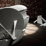
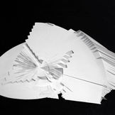
Aperture f/2 is a conceptual sculpture about time and light. Aperture f/2 investigates the relationship between the optics of the human eye, the mechanics of a constructed lens and earths relationship to the sun. The opening of the sculpture is placed in a direct line between where the earth’s orbit meets the sun on the East and West horizon lines, turning a recording device into a focal point in itself. The artwork takes the brief moment of optically capturing light and suspends it in a bronze structure, stretching it out in time.
SEISMIC FIELD / 2018
Seismic Field examines the relationship between geophysical forms and consciousness. Geurts intervenes the processes of scanning, polaroid photography and 3d mapping as site actions, disrupting the form and colour field, blurring the lines between geology and technological praxis. The works investigate seismic phenomena and cultural context, amplifying their perceptual and physical thresholds. Seismic Field draws together site and conceptual works from diverse locations around the world, from the edge of tectonic plates colliding in Italy, exposed fault lines from Bendigo, to meridians and time zones shaped by geopolitical forces. This exhibition also navigates archaeological objects that have been forged in the cultural strata. The works operate as abstract measuring propositions, exploring these forces physically and symbolically.
- Art Guide Australia
The Adelaide Review
Art and Australia Review
FLOOD PLAIN
NATIONAL GALLERY OF VICTORIA
/ 2018
Floodplain identifies a series of sites and cultural institutions along the floodplain of the 242 kilometre Yarra River (Birrarung) to examine conceptually where the ancient river and the contemporary city collide.
Based on more than six months of field and archival research undertaken by James Geurts at the State Library Victoria and Melbourne Water, this project explores the impact of floods on the environment and their residue. Floodplain examines where the river has been significantly rerouted or widened over time, in order to influence the potential of future floods, and it draws out unique connections between the river and key cultural institutions situated within the Yarra floodplain.
This project suggests the natural power of great floods through a series of photographs capturing site-specific light installations. The neon sculptures by Geurts signal the high-water marks of historic Yarra floods, and represent the debris and residue left after the water has subsided.
His photographs, taken at the intersection of day and night, give form to the invisible force and breadth of floods.
TOPOGRAPHY OF WATER / 2014
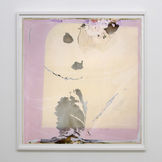
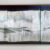
Topography of Wateris a series of site and time-specific works on paper and Polaroid photographic works made at various water bodies around the world. This series of works was made at threshold sites, the meeting place of two bodies of water: Sydney Harbour/Pacific Ocean; St Lawrence River/ Saguenay River, Quebec, Lagoa de Obidos /Atlantic Ocean, Portugal, Halifax Harbour/Atlantic Ocean, Nova Scotia; Birrarung River /Port Phillip Bay, Victoria; Towamba River/ Twofold Bay, Eden; Tidal River/Bass Strait, Victoria; Upper Yarra Resevoir/Birrarung River, Victoria.
Drawing In, Drawing Out: Sydney Harbour/Pacific Ocean,was made on-site during the in and out going tides, drawing toward and away from the body consecutively, relating the five-hour tidal moment to breathing in and breathing out.This process is referred to as ‘psycho-topographical mapping’ – a practice associated with psychogeography and its exploration of place and perception. Frequently the works are developed across a number of media in response to a single site in what Geurts refers to as ‘expanded drawing practice’.He gains a sense of each place through extended periods of fieldwork, taking note of what the site reveals, hides and suggests over time.
Drawing : Psychogeographyworks involve modifying the developing process of large format Polaroid photography at each site. Geurts exposes the chemical layers of the film to extreme temperatures, humidity and salinity, whilst drawing out abstractions through his gestural intervention on the film’s surface. These gestures seek to align with the physical dynamics, atmosphere and psychological states suggested by the site. This process of combining drawing techniques to translate a sense of space and the movement of water bodies aims at an ‘expanded potentiality’ of experience that conveys both the shared and distinct features of the geographical locations in which he has worked around the globe.
In 2013 Geurts established an ongoingconceptual art project called the Embassy for Waterthat functions as a curatorial and critical umbrella for a water-based series of artworks and events. Embassy for Wateractivates the central role of water as a physical and imaginary presence in the interwovenwaterways throughout the world, with which the human water-body is a part.
Through this spatial multiplicity, Embassy for Waterdraws together particular water flows as part of an inescapably global water body that defies national boundaries. In collaboration with artist and curator Julie Louise Bacon (UK/AU), he devised an iteration of the Embassy for Waterthat formed part of Leeuwarden’s successful bid to be named European Capital of Culture 2018. This will result in a year-long program of art events in the Dutch city and the surrounding area.
- James Geurts, 2014


